
ne sledite
Napaka pri sledenju uporabnika.
Ta uporabnik drugim uporabnikom ne dovoli, da mu sledijo.
Temu uporabniku že sledite.
Vaš paket članstva omogoča samo 0 sledenj. Nadgradite tukaj.
Sledenje je bilo uspešno preklicano
Napaka pri preklicu sledenja uporabnika.
Uspešno ste priporočili
Napaka pri priporočanju uporabnika.
Nekaj je šlo narobe. Osvežite stran in poskusite znova.
E-naslov uspešno verificiran.

toukh,
egypt
Trenutno je 3:42 dop. tukaj
Datum pridružitve maj 28, 2020
0
Priporočila
Mohamed A.
@Geomatician
2,6
2,6
83%
83%
toukh,
egypt
100 %
Opravljeno delo
100 %
V okviru proračuna
100 %
Pravočasno
14 %
Stopnja ponovnega najema
GIS Specialist | QGIS | ArcGIS | Google Maps
Stopite v stik s/z Mohamed A. glede vašega dela
Prijavite se, da se o podrobnostih pogovorite v klepetu.
Portfelj
Portfelj
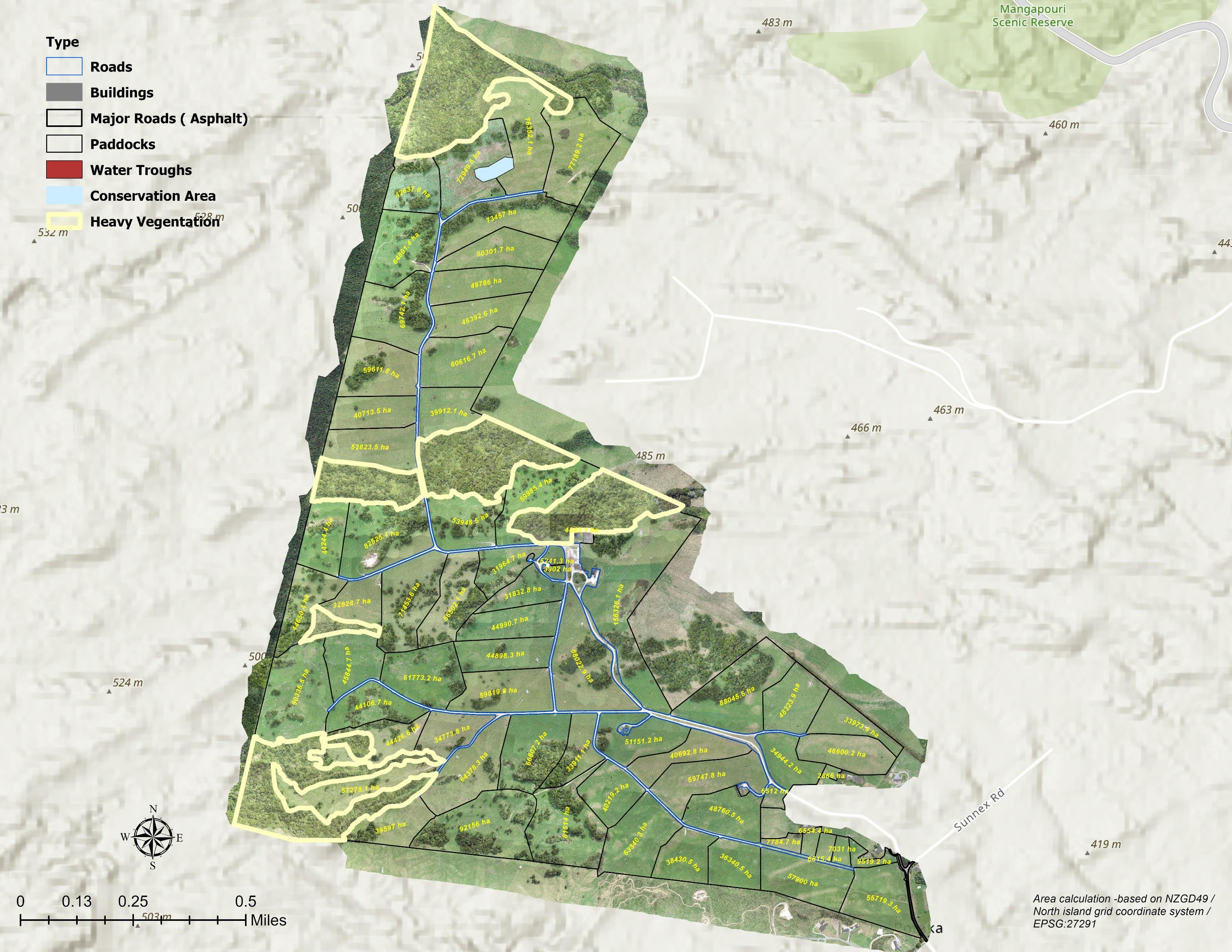

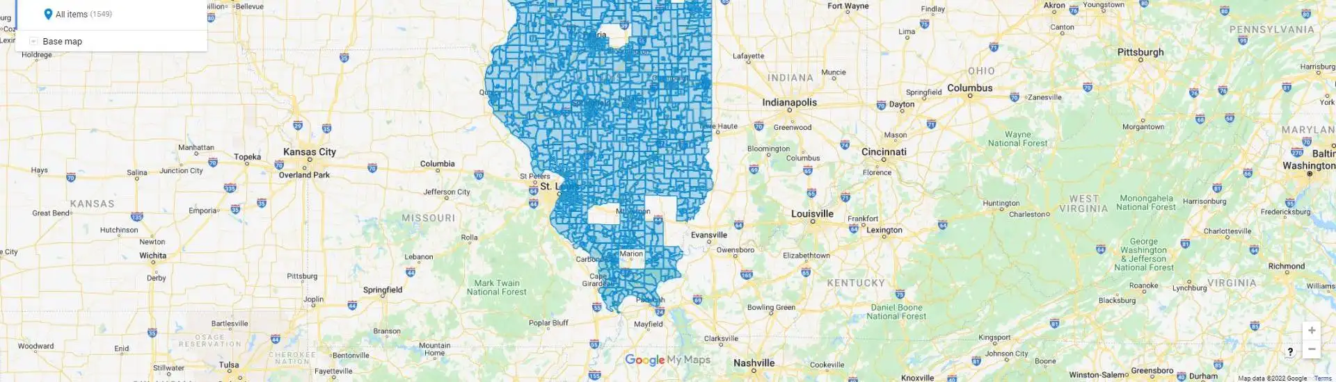
Trace Agriculture Area

Creating Heat Maps

Creating Heat Maps

Creating Heat Maps
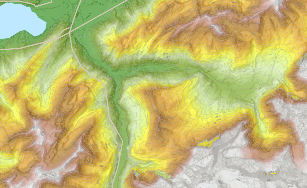

Creating High Accuracy DEM with Hillshade

Creating High Accuracy DEM with Hillshade
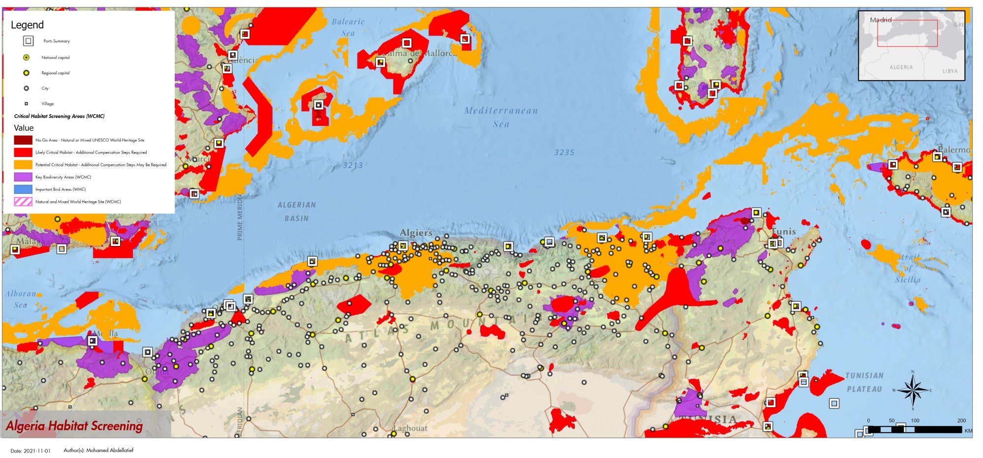

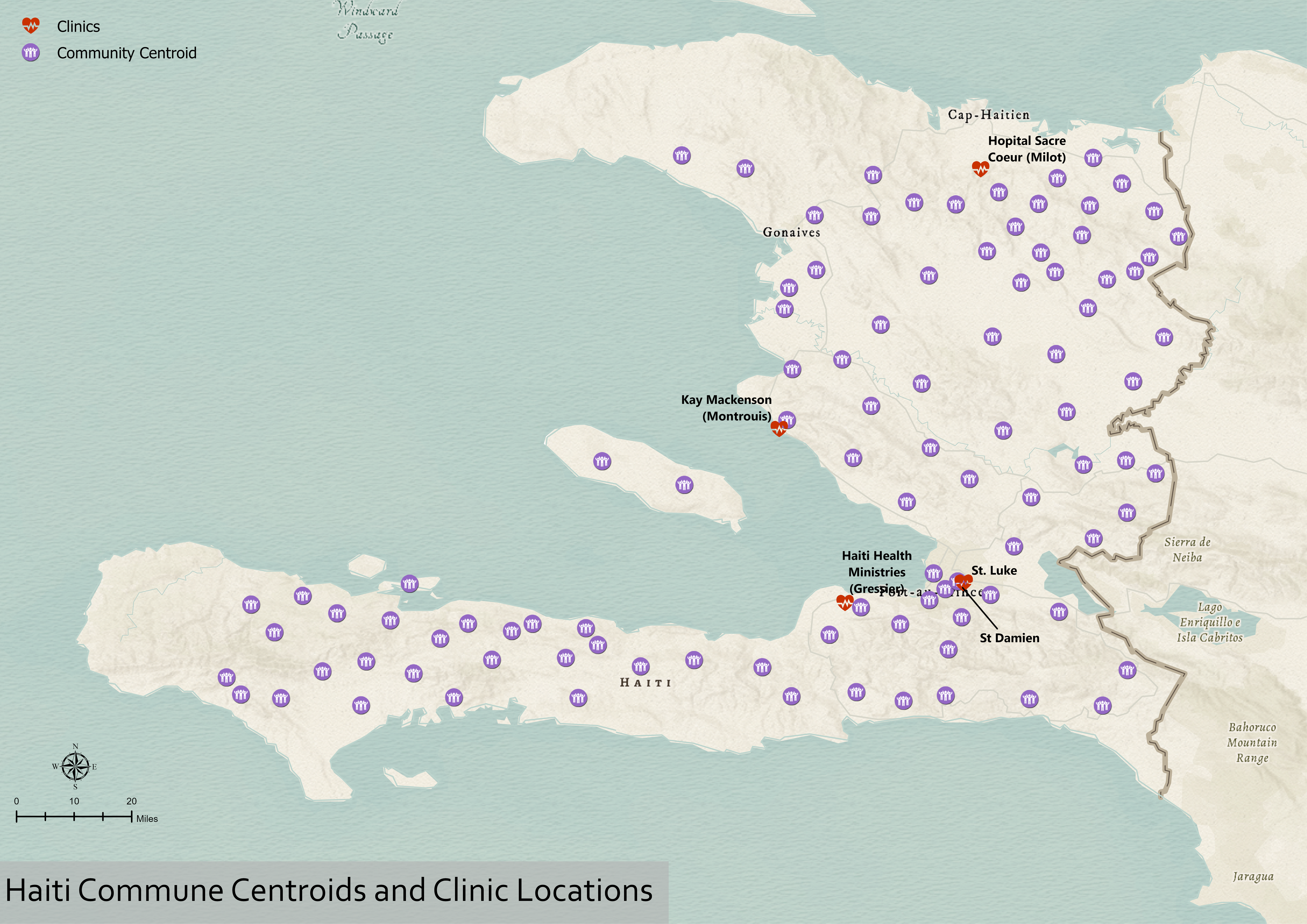
GIS Analysis and mapping for Algeria Critical Habitat Screen
Trace Agriculture Area
Creating Heat Maps
Creating Heat Maps
Creating Heat Maps
Creating High Accuracy DEM with Hillshade
Creating High Accuracy DEM with Hillshade
GIS Analysis and mapping for Algeria Critical Habitat Screen
Ocene
Spremembe shranjene
Prikazanih je1 - 3 od 3 ocen
$100,00 AUD
Cartography & Maps
Geolocation
Geospatial
ArcGIS

•
$30,00 USD
Cartography & Maps
Data Visualization
ETL
ArcGIS
+1 več
L

•
$95,00 USD
Cartography & Maps
Data Visualization
ETL
ArcGIS
+1 več

•
Izkušnje
Geoinformation Analyst
jul. 2017 - Trenutno
Managing GIS data for exploration and development studies
Izobrazba
Bsc of science in Geomatics Engineering
(5 let)
Stopite v stik s/z Mohamed A. glede vašega dela
Prijavite se, da se o podrobnostih pogovorite v klepetu.
Verifikacije
Certifikacije
Vabilo uspešno poslano!
Hvala! Po e-pošti smo vam poslali povezavo za prevzem brezplačnega dobropisa.
Pri pošiljanju vašega e-sporočila je šlo nekaj narobe. Poskusite znova.
Kopiranje v odložišče ni uspelo, poskusite znova po spremembi vaših dovoljenj.
Skopirano v odložišče.
Nalaganje predogleda
Geolociranje je bilo dovoljeno.
Vaša prijavna seja je potekla, zato ste bili odjavljeni. Prosimo, da se znova prijavite.